 by
by Midwest Braces for 70-Mph Winds: Tornado Warnings Hit Ohio, Indiana, Michigan
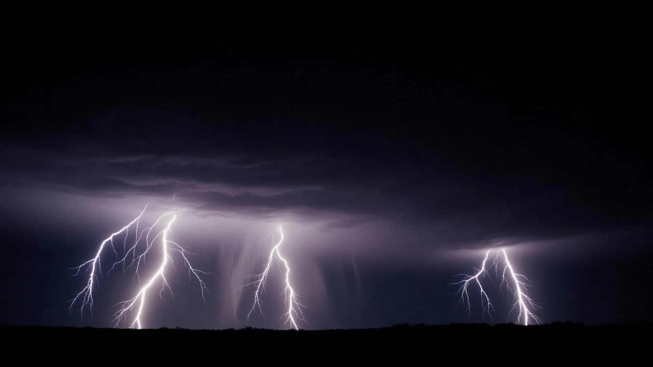
26 May, 2026When the sky turned an ominous shade of green over Northwest Ohio on May 26, 2026, residents didn't just hear thunder—they felt the ground shake. A violent line of thunderstorms is currently tearing through the Midwest, packing wind gusts of up to 70 miles per hour. The National Weather Service has issued severe warnings across multiple counties in Ohio, Indiana, and Michigan, with active tornado alerts for Hillsdale County and Williams County.
The situation is evolving rapidly. As of early evening, a severe thunderstorm watch remains in effect until 10:00 p.m. Eastern Time. But for those in the immediate path, the danger isn't future—it's now. Meteorologists are tracking a system moving eastward at speeds matching its own destructive potential: 60 to 70 mph.
A Wall of Wind Moving East
Here’s the thing about squall lines like this: they don’t ask permission before they arrive. This particular band of storms is exhibiting characteristics similar to a derecho—a widespread, long-lived wind storm. While not officially classified as one yet, the sheer speed and intensity suggest it could leave a trail of devastation stretching hundreds of miles.
The core of the action is centered around the tri-state area where Ohio, Indiana, and Michigan meet. Counties including Allen, Defiance, Fulton, and Williams in Ohio are tagged as 'considerable risk.' The forecasters aren't mincing words; winds of 60-70 mph are enough to snap mature trees and down power lines with alarming frequency. In fact, these thresholds exceed the standard definition of a severe thunderstorm, which requires only 58 mph gusts or hail larger than a quarter (1 inch in diameter).
"These storms are still packing a punch," noted the Weather Impact ALERT broadcast, emphasizing that the threat level hasn't diminished despite the late hour. For residents in the Toledo Metro area, the arrival time was predicted to be before 7:00 p.m. ET. By the time the clock struck seven, areas further east, including Sandusky County and Port Clinton, were bracing for impact.
Tornado Risks and Localized Threats
While wind is the primary hazard, the threat of rotation persists. A specific tornado warning is active for Hillsdale County in Michigan and Williams County in Ohio. This distinction matters because while high winds cause widespread property damage, tornadoes pose an immediate life-threatening risk to structures and individuals caught outside.
The National Weather Service monitors these developments closely. When a storm system moves this fast—racing eastward at 60-70 mph—the window for preparation shrinks dramatically. Residents in Lenawee, Henry, and Fulton counties have been urged to seek shelter immediately if they hear sirens or see rotating clouds.
It’s worth noting that the definition of "severe" varies globally. The Meteorological Service of New Zealand defines severe winds at 110 km/h (68 mph), whereas the U.S. standard kicks in at 93 km/h (58 mph). Regardless of the metric, the physical reality on the ground is the same: debris flying, roofs lifting, and visibility dropping to near zero due to rain and dust.
Impact on Infrastructure and Daily Life
The ripple effects of such a storm extend far beyond the initial flash of lightning. According to the Saffir-Simpson Hurricane Wind Scale, winds in the 60-70 mph range fall below hurricane strength but still cause significant structural damage. Fallen trees and power poles can isolate residential areas, leading to power outages that may last days or even weeks in extreme cases.
For emergency services, the challenge is twofold: responding to immediate threats while navigating hazardous road conditions. High rainfall rates, often accompanying such intense convection, raise the specter of flash flooding. Environment Canada includes high rainfall in their severe criteria, and while this event is driven by wind, water accumulation in urban areas like Toledo and Cleveland suburbs could exacerbate traffic chaos and hinder rescue efforts.
Businesses along Interstate 75, particularly those east of the highway toward Port Clinton, have likely suspended operations. Schools and public venues in the affected counties would have canceled events well before the warnings hit their peak. The economic cost, measured in lost productivity and repair bills, will become clear only after the skies clear.

What Comes Next?
As the system pushes past the Maumee River and heads toward the Lake Erie shoreline, the intensity may begin to wane slightly due to cooler lake waters. However, meteorologists warn that the tail end of such systems can still produce damaging gusts. Residents east of I-75 should remain vigilant until the 10:00 p.m. watch expires.
This event serves as a stark reminder of the volatility of Midwest spring weather. With 70% of all derechos occurring between May and August, we are squarely in the season when these atmospheric bombs are most likely to detonate. The coming hours will determine whether this passes as a localized severe weather event or evolves into a broader regional crisis.
Frequently Asked Questions
Which counties are under the most critical warnings?
The most critical alerts include tornado warnings for Hillsdale County in Michigan and Williams County in Ohio. Severe thunderstorm warnings cover Allen, Defiance, Fulton, and Henry counties in Ohio, as well as parts of Indiana and Michigan. These areas face wind gusts of 60-70 mph.
When will the severe weather watches expire?
Specific severe thunderstorm warnings for some counties expire at 6:30 p.m. Eastern Time. However, a broader severe thunderstorm watch remains in effect until 10:00 p.m. ET for the region, including areas east of Interstate 75.
What constitutes a "severe" thunderstorm in the U.S.?
According to the National Weather Service, a thunderstorm is classified as severe if it produces wind gusts of at least 58 mph (93 km/h) or hail of at least 1 inch (2.5 cm) in diameter. The current system exceeds both thresholds.
Is this storm system considered a derecho?
Not officially at this time. A derecho requires a wind damage swath extending more than 240 miles with gusts of at least 58 mph along most of its length. While this system shares characteristics with a derecho, it must travel further to meet the classification criteria.
How should residents prepare for 70-mph winds?
Residents should secure loose outdoor objects, avoid driving if possible, and stay indoors away from windows. If a tornado warning is issued, move to a basement or interior room on the lowest floor. Keep emergency supplies ready in case of prolonged power outages.